-
cambridge University Foundation
So far we have worked our way through 300,000 years of Cambridge’s history. Through ancient times, the Roman boom and the ‘dark-ages’. As the ‘dark-ages’ came to an end Cambridge began to expand and dominate the wider area. But the end of the ‘dark-ages’ in England brought with it more invasions: Viking raids and then the Norman Conquest of 1066. Now we will explore how Cambridge navigated these turbulent decades to emerge as the administrative centre for the area. And how it grew in prosperity to ultimately have one of the greatest fairs in medieval Britain.
The Viking Invasions
By the end of the dark ages Cambridge was starting to flourish. The Mercian King Offa had built a bridge and from this it got its new name: Granta Brycge (Bridge over the River Granta). But in the 9th century Anglo-Saxon England came under threat from the Viking invasions. Due to its eastern location East Anglia was very vulnerable to these Scandinavian attacks. It began with pirate-style raids on the coast far from Cambridge but it soon progressed into full on invasion.
The Anglo-Saxon Chronicle describes how in 875 the Danes ‘went from Repton to Cambridge with a great host, and remained there a year’. Things continued to get worse for the Anglo-Saxons. By 886 the Danish kings had conquered large parts of the East. A peace was eventually made with the English king where the invaders would rule over an area known as the Danelaw, of which Cambridge was part.
Like all rulers of the region, the Danes needed a well-defended trading position and administrative centre. And like previous rulers they chose an area within what is now the modern city of Cambridge. Their base appears to have been along the south bank of the river and was defended by ditches. It is an area which today includes the parish of St Clement’s. The name St. Clement’s is itself Dutch and its riverside location was standard for Danish worship.
At this point Cambridge was given another new name: Hulmum from the Danish ‘Homr’ meaning ‘higher dry ground amidst the marshes’. A name which clearly explains why the site was selected in the first place. The new Danish defences joined up with the existing defences to create a well-defended inland port.
However, a few decades later in 917 Edward the Elder, son of King Alfred reconquered the Danelaw. It was in this new period of English rule that the town was expanded to the south. Further Saxon settlements also emerged in the villages of Cherry Hinton, Trumpington and Chesterton (the name Chesterton comes from its original name Cestretone meaning ‘farm by the fortified place’ – the fortified place being the iron age fort in what is now Arbury).
But this period of peace was not to last. In the early eleventh century the Viking forces invaded once more. The men of Cambridgeshire reportedly stood bravely against the Vikings whilst the East Angles fled. But their defence was futile. The Vikings burned their way through the fens. The defences of the town proved useless and Cambridge itself was burned. But this did not seem to hamper its development for long.
Norman Cambridge
In 1066 William the Conqueror and his army crossed the English Channel. Following victory over King Harold at Hastings the Normans ruled England. They brought huge changes to the country.
The early days of William the Conqueror’s reign were filled with castle building campaigns. The Norman invaders knew little of England’s geography. But they did know that the shires were governed from shire towns. These towns were often already defended (usually still using the defences left from the Romans) and controlled crucial roadways and river crossings. So, this is exactly where King William decided to build his castles.
Cambridge had emerged as the major centre for the region. There were 3 mills on the River and there was also a royal mint. Here silver coins of Alfred, St Edmund, Edgar and Ethelred II were printed. There is also evidence that foreign merchants were trading in the town – presumably travelling down the River to reach the town. This combined with its high (for Cambridgeshire) vantage point and existing defences made it the logical choice for one of William’s castles.
In Cambridge the hill-top was now longer as densely occupied as it had been under the Romans. However, there were still 27 houses torn down to make room for the new castle. Over the following centuries the castle was rebuilt and expanded numerous times. However, the only complete element that we can still see today is the original motte (essentially a mound of earth) built in these early days of Norman rule.
This first castle consisted of a flattened cone of earth standing about 17m above ground level with a wooden tower. To the south there was a deep water-filled ditch around the base and another wet ditch with a bank and fence forming a bailey in front of it. To the north east the castle made use of the old Roman ditch. The first castle was left in the possession of the unpopular sheriff Picot, described in a chronicle written by the monks of Ely as ‘a hungry lion, a ravening wolf, a filthy hog’.
The castle was a busy place for the next two centuries. It had a primary purpose of keeping the town under royal control. However, it also served as a prison and the site of monthly courts and tax collection. It was rarely used for a defensive purpose. It was perhaps used in the fight against Hereward the Wake in 1070 but it was not significant in the battles. It also proved a failure later at protecting the town against rebel attacks leading to extensive redevelopment by Edward I. This building work done between 1283 and 1299 cost £2500 and replaced the wooden building with a stone one. But this happens much later in Cambridge’s story…
A Flourishing Town
By the end of the eleventh century most inhabitants of Cambridge were still involved in farming. But there was also an increasing amount of employment in other industries. The area became the most densely settled and economically prosperous part of the country in the Middle Ages. The location of Cambridge was perfect. It could be reached by land or water from most of the country and from the continent.
Cambridge flourished on trade from the 12th century. Goods would be brought into the city from the surrounding fenland to be traded. Goods were transported into the city along the shallow, narrow waterways by flat bottomed punts (still a popular tourist activity in the town today). Local goods included fresh-water fish and eels. Goods could then be sold to merchants from elsewhere in the country or all the way from the continent. Meanwhile the trade worked in the other direction. Goods arrived in England from Europe at King’s Lynn. They were then transported up the River to Cambridge for redistribution around the country.
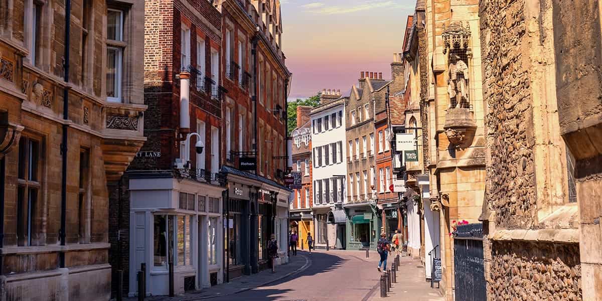
Cambridge was therefore filled with markets by the later twelfth century. Many of these lay in the modern day centre of the city, underneath what is now the famous university buildings and iconic tourist attractions. There were specific areas of the city for the selling of certain products. These locations were reflected in the original street names. For example, Buthchery Row (now called Guildhall Street) and Slaughterhouse Lane (now Corn Exchange Street). The area stretching from the Mill Pond to Magdalene Bridge was where goods would be unloaded and re-loaded. Today it is filled with hundreds of tourists seeing the beautiful ‘Backs’. A short stretch of river which has been bringing wealth into the city for centuries.
In addition to this constant trade there were also four annual fairs held just outside the town. Fairs were huge events with merchants travelling from far and wide to sell their goods as well as attractions put on to entertain the crowds. One of these: Stourbridge Fair became internationally famous as Britain’s greatest commercial gathering. The origins of the fair are unknown. It’s location adjacent to the river made it easily accessible from anywhere in the country. It also benefited from good timing: being held in September each year just after the harvest meaning there were plenty of crops to be sold and people had money. It was this fair that placed Cambridge on the international stage whilst the university was still in its fledgling state.
But the other fairs: Garlic Fair, Reach Fair and Midsummer Fair were prosperous in their own right. The right to hold Midsummer Fair was officially granted to Barnwell Priory in 1211 but it likely dates back much further than this. It is still held in June on Midsummer Common in the city centre. But is now more of a fun fair and for the first time in ages could not happen the past two years due to the Covid-19 lockdown.
Conclusion
So during the course of a turbulent few centuries Cambridge managed to prosper and grow despite the odds. Little remains now of the town that was here back then. Just a mound of earth where William the Conqueror’s castle once stood. But there is one building (or part of a building) which still remains: St Bene’t’s Church, just off King’s Parade.
This Church dates back to around 1020 – just as Cambridge was really starting to come into its own as a place of trade. As the town grew new churches popped up to serve the religious needs of the ever growing population. St Bene’t’s was a substantial and costly build for the town and reflects the wealth and prosperity of the area. It’s original stone tower still stands today making it the oldest building in the city.
As Cambridge became internationally known for trade, wealth in the city grew substantially. By the time the Domesday Book was created in 1086, the wealth of Cambridge was only rivalled by London, Norwich, York and Bristol!
Thus, it is no surprise that in 1207, Cambridge was given its official charter to become a town and elect its own mayor. But, this charter was received just 2 years before discontent elsewhere in the country was about to have an impact on Cambridge that would dramatically alter its future.
Read our next blog to find out how Cambridge changed forever.
More articles
-
On the Shoulders of Giants : Newton, War & Modernity
-
Later Medieval Cambridge